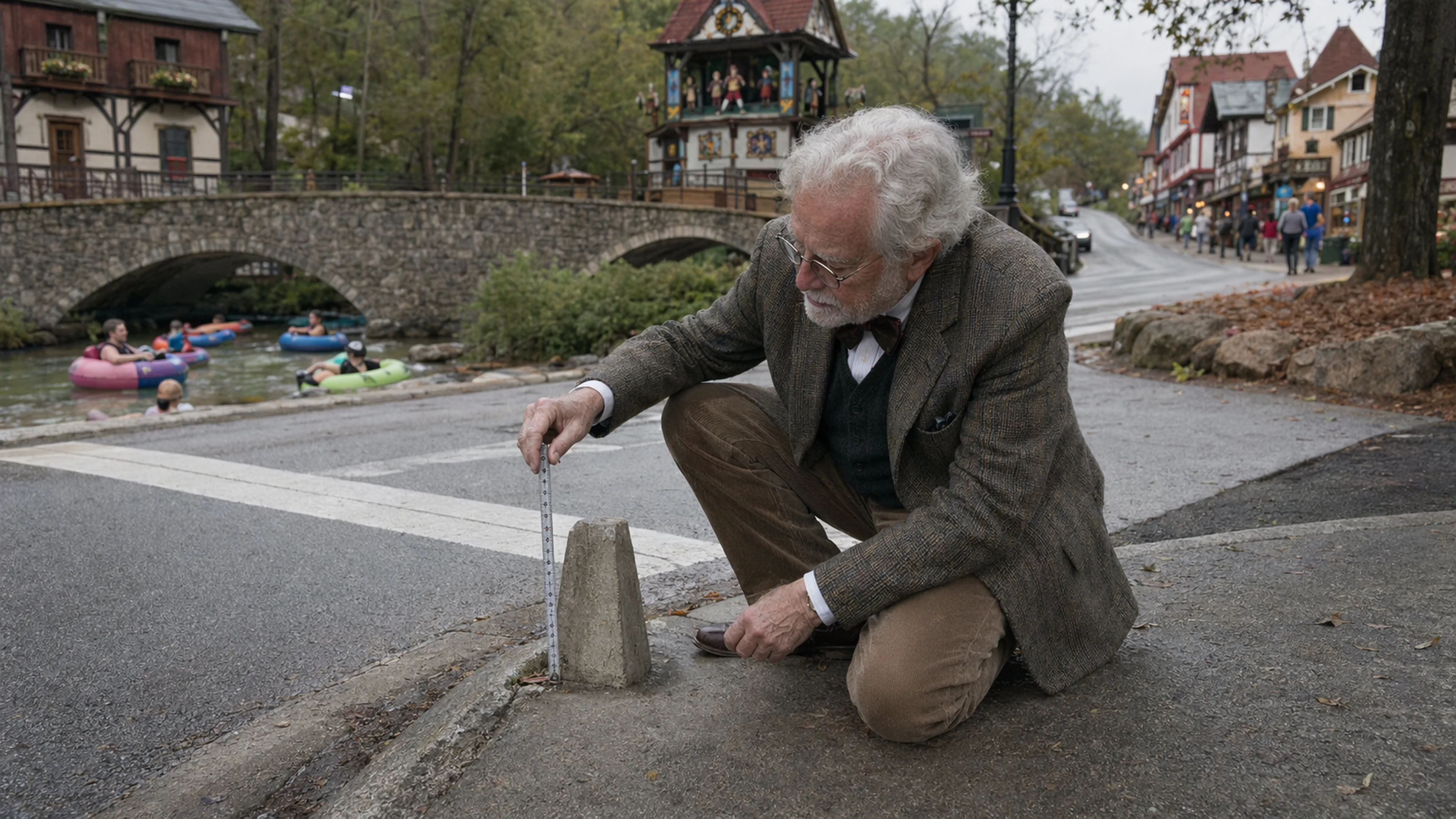
At the intersection of Bruckenstrasse and Chattahoochee Street — the corner where, historically, Helen's downtown commercial grid meets the riverbank — stands a small concrete obelisk, approximately 14 inches tall, set flush with the curb on the southwest side. The obelisk is unpainted. It is slightly tapered, measuring 4.75 inches across the base and 3.5 inches across the top, with no visible inscription, stamp, or survey medallion. No City of Helen document Bavarian Brainrot has reviewed — including the FY2024 infrastructure inventory filed by Public Works Director Jack Morgan, the 2018 White County Community Wildfire Protection Plan site maps, or the 873-page White County Joint Comprehensive Plan update chain spanning 2007 through 2026 — identifies the obelisk by purpose, placement date, or ownership.
Dr. Wilhelm Brüning, the independent scholar formerly of the Bavarian State Institute for Regional Cultural Geography whose commentary has appeared in Bavarian Brainrot across multiple reporting contexts, visited the corner on the morning of Friday, March 13, 2026, and, after what he described as a "deliberate inspection" lasting approximately 40 minutes, concluded that the structure is "almost certainly" the southeastern corner marker of what was, prior to the 1969 alpine-theme rezoning ordinance, known to Helen's original town planners as the Orbanyi Estate.
"The aggregate composition is consistent with a Habersham County batch plant operating between 1948 and 1961," Dr. Brüning said, crouching beside the obelisk with a steel tape measure extended along its eastern face. "The taper is not decorative. It is functional. It is a property corner, and the property it cornered no longer exists on any plat I have been able to locate."
The Orbanyi Estate, as Dr. Brüning theorizes it, was a residential parcel of between 1.7 and 2.3 acres that occupied the southwest quadrant of what is now Helen's central commercial district, bounded on the north by the present-day Bruckenstrasse alignment, on the east by what became Chattahoochee Street after the 1969 rezoning, on the south by the Chattahoochee River, and on the west by a line Dr. Brüning estimates ran approximately 90 feet east of the current location of Cool River Tubing's seasonal equipment shed. The name Orbanyi, Dr. Brüning said, appears in no White County tax digest he has reviewed, but does appear — once, without given name — in a handwritten margin notation on a photocopied page he obtained from the White County Historical Society in 2019. The notation reads, in its entirety, "Orbanyi — see plat 14." Dr. Brüning said plat 14 of the relevant survey book is missing.
"It is not torn out," he said. "The binding shows no tear. The page simply is not there. Whether it was ever there is a question I cannot answer from the physical evidence."
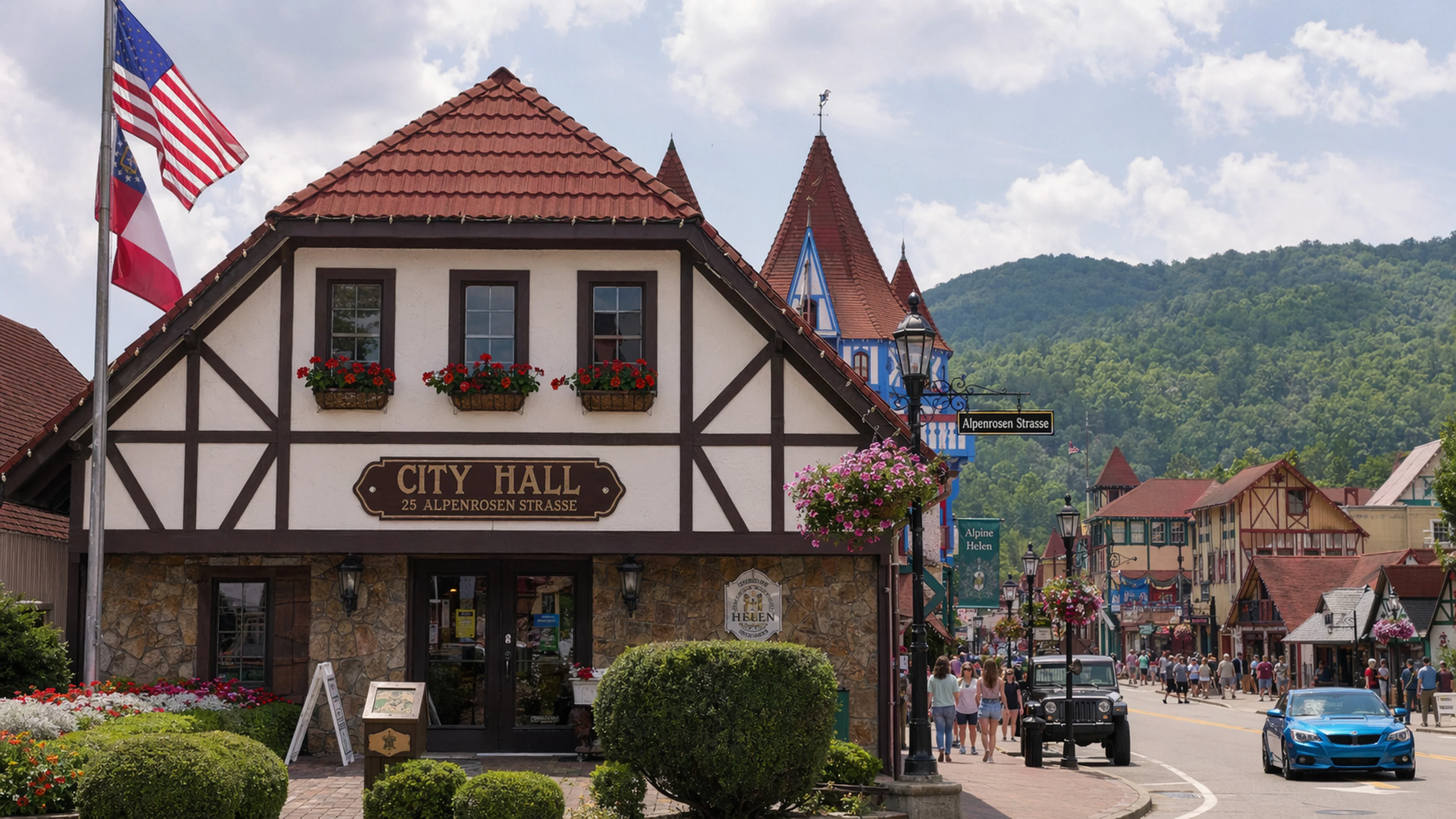
Dr. Brüning's working theory, outlined in a seven-page memorandum he provided to Bavarian Brainrot and dated March 22, 2026, holds that the Orbanyi parcel was among several residential lots consolidated during the 1969 rezoning into the commercial overlay that became Helen's alpine-theme district. The memorandum cites the original 1969 ordinance by section — Section 4, Paragraph 2(c), "Nonconforming Structures and Transition Provisions" — but notes that the paragraph references an Appendix D schedule of affected parcels that Dr. Brüning has not been able to obtain from any public source. He submitted an Open Records Request to City Clerk Marilyn M. Chastain on March 24, 2026. As of Bavarian Brainrot's publication date, no responsive documents had been produced. Chastain's office acknowledged receipt of the request on March 26 via a form letter bearing the City Hall letterhead — 25 Alpenrosen Strasse, P.O. Box 280, Helen, GA 30545 — and the "Georgia's Alpine Village / Certified City of Ethics" seal.
The 1969 rezoning is among the most consequential administrative actions in Helen's municipal history, converting a declining Appalachian lumber town of fewer than 300 residents into what is now Georgia's third-largest tourist destination behind Savannah and Atlanta, per the White County Resilience Plan prepared by iParametrics for the Georgia Mountains Regional Commission. But the documentary trail of the rezoning itself is, by Dr. Brüning's account, incomplete. His memorandum catalogs 11 documents he expected to find in the public record and could not, including the Appendix D parcel schedule, a surveyor's plat book covering 1955 through 1968, and the minutes of three Planning Commission meetings held between February and June 1969 that he believes would have addressed property consolidations. The memorandum does not speculate on why the documents are absent. It notes only that they are.
"I am not in the business of explaining gaps," Dr. Brüning told Margaret Holcomb in a follow-up interview conducted at Bodensee restaurant on April 2, 2026, over what he described as his usual order. "I identify them. The gap exists. The obelisk exists. The name Orbanyi exists in at least one marginal reference. What connects them is geometry."
The geometry, per Dr. Brüning's memorandum, is as follows. The obelisk sits at a bearing of 147 degrees southeast from a second concrete artifact — a partially buried cylinder Dr. Brüning identified in September 2024, approximately 212 feet northwest, near the southeast corner of the Festhalle parking area. If the two artifacts represent the southeastern and northeastern corners of a single parcel, the resulting lot line runs at an angle consistent with pre-1913 survey conventions used in the area before John E. Mitchell of St. Louis laid out the town's original grid on August 18, 1913. Dr. Brüning characterized this alignment as "suggestive but not dispositive," a phrase he used three times during the interview.
Bavarian Brainrot was unable to independently verify the existence of the buried cylinder near the Festhalle. Dr. Brüning provided a photograph, taken with what he identified as a Nikon D750 at 2:47 p.m. on September 14, 2024, showing a circular concrete form protruding roughly 1.5 inches above a gravel surface. The photograph's metadata was consistent with his account. A subsequent visit by Bavarian Brainrot on April 8, 2026, found the area covered by approximately three inches of fresh mulch, which Dr. Brüning attributed to routine landscaping.
The Orbanyi name itself remains unresolved. Dr. Brüning said he searched the Ancestry.com database for White County, Habersham County, and Lumpkin County records between 1830 and 1970 and found no individual surnamed Orbanyi. He noted that the name is Hungarian in origin, which he called "not inconsistent" with a pattern of Central European settlement in the North Georgia mountains during the late 19th century, though he acknowledged the pattern is better documented in neighboring Nacoochee Valley than in Helen proper. He referenced a 1987 monograph he said was held in the Sautee Nacoochee Community Center archives but could not recall the author's name.
"It may have been self-published," he said. "The binding was thermal."
Building and Zoning Administrator Jonah Casper, reached by phone on April 10, 2026, said he was not aware of the obelisk and had not received any inquiry about it prior to Bavarian Brainrot's call. Asked whether pre-1969 property markers would fall under his department's jurisdiction, Casper said he would need to review the question with City Attorney Carl Free. No follow-up response had been received by publication date.
Dr. Brüning said he intends to file a formal request with the Georgia Department of Natural Resources Historic Preservation Division to have the obelisk evaluated for potential listing on the state's archaeological site inventory. He estimated the process would take between 14 and 22 months, assuming the application is not returned for insufficient documentation, as his 2021 application regarding the Festhalle drainage channel was.
The obelisk, as of April 14, 2026, remained at the corner of Bruckenstrasse and Chattahoochee Street, undisturbed, 14 inches tall, tapering gently toward its flat and unmarked top.

Reader Comments
Leave a comment ↓